On June 13, 2022, Park, Stillwater, and Carbon Counties experienced damaging floods. Late snowfall mixed with heavy rains and warmer temperatures sent high velocity floodwaters and devastated communities throughout these three counties. High water and heavy debris in all three counties scoured banks and changed the topography of the rivers and streams. In connection with this historic flood the counties collaborated with DNRC, and FEMA to update the floodplain maps.
Community Meeting Information:
Kick off meetings were held with community officials on:
9/19/2022 Carbon County Click here to view materials from the meeting
9/19/2022 Park County Click here to view materials from the meeting
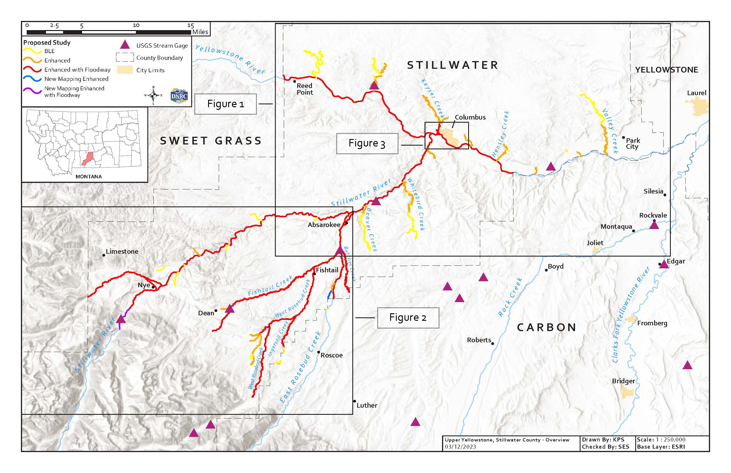
9/19/2022 Stillwater County Click here to view materials from the meeting
Historic flood map information:
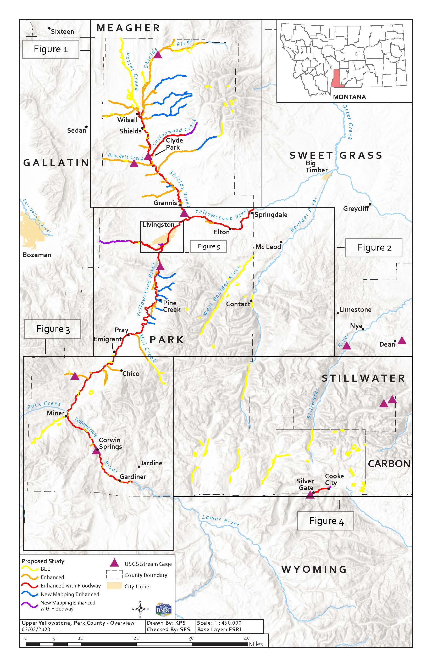
Park County has had a few areas of the county with updated studies, smaller sections, but has not had a full study of the entire county. Most of the updated data was collected in 2005 for a small section of the Yellowstone River and a few LOMRs that were included in Map Mod (digitizing old paper maps with no new study conducted) in 2011. Most of the rest of the maps are based on data that was collected in the late 1970s.
The Yellowstone River, among multiple tributary streams, including the Shields River and various tributaries, make up the approximately 538.3 miles of mapped floodplains within the county.
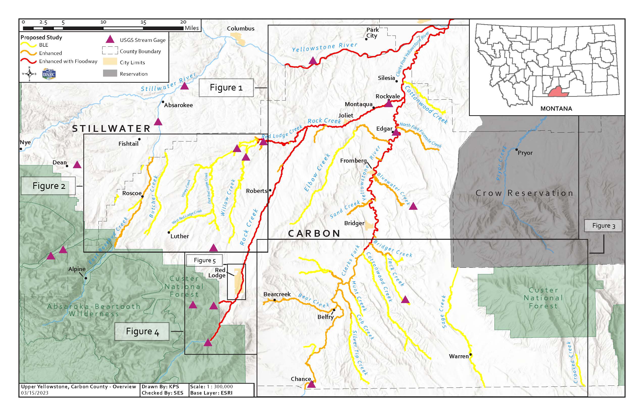
New Flood Study Extents:
Historic flood map information:
In 2013 an updated study was conducted by USACE on the Yellowstone River. The 2013 study replaced Zone A with a Zone AE floodway study. That new study extended from the upstream boundary of Sweet Grass County to the downstream boundary of Yellowstone County, a reach of approximately 44 miles. That study utilized LiDAR, ground, bathymetric and bridge survey data collected for the project between 2004 and 2010. Two LOMRs were conducted in 2021 but the rest of the maps are based on data collected in the late 1970s.
New Flood Study Extents:
Historic flood map information:
In 2019 DNRC applied and received grant funding to update most of Carbon County that was modernized through the DFIRM project in 2012. The 2012 DFIRM project entailed digital conversion of the effective floodplains in the county, with the exception of revised hydraulics and mapping on 9 miles of the Clarks Fork of the Yellowstone (upstream from the Carbon/Yellowstone County border). June 29th, 2022, DNRC was going to conduct Flood Risk Review with the County, Towns of Red Lodge, Joliet, Bear Creek, and Fromberg. Due to the extensive flooding and changes to the rivers and streams an evaluation of the flood damage needs to be conducted with updated LiDAR and survey work to evaluate the existing study.
New Flood Study Extents: